For A Lay Of The Land, the LiDAR Scanner is inside the smaller, square Flight Control Office at Control Tower A6 on Spaceport—not the tall locked tower. Complete the Jiangsu Warehouse objective first, then search the low metal box on the building’s upper interior floor and extract with the scanner in the same round.
What you need to know
- Quest: A Lay Of The Land
- Trader: Shani
- Map: Spaceport
- Prerequisite: A Reveal in Ruins
- Required item: 1 LiDAR Scanner
- Important: The objectives must be completed in one deployment.
The full sequence is: reach Jiangsu Warehouse, find the shipping notes in the foreman’s office, locate the scanners at Control Tower A6, and deliver one scanner to Shani. The quest rewards are one Dam Testing Annex Key, three Zipline items, and two Smoke Grenades.
As an Amazon Associate I earn from qualifying purchases.
Exact Control Tower A6 route
- Enter the smaller square Flight Control Office at Control Tower A6 through its main entrance. Do not climb the tall tower or search its roof.
- From the lobby, go left past the statue.
- Find the door to the staircase and go upstairs.
- When you reach the upper-floor exit, turn right.
- Continue past the nearby zipline area, then turn right again toward the divider walls and cubicle-like spaces.
- Search the low metal box behind the low dividers and boxes to collect the LiDAR Scanner.
The scanner is a quest item. Reaching the room or triggering an objective is not enough: use the interaction prompt on the metal box and confirm that the scanner appears in your inventory. The exact button label can vary by platform and should not be confused with a separate rooftop objective.
Free tools Windows power users keep installed
One-click scans. No signup required.
Do you need the Spaceport Control Tower key?
No. The key is not required for this quest objective. The scanner is on the accessible upper interior floor, below the key-restricted top-floor or roof room.
#1 Best Overall
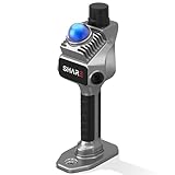
- 1cm High-Precision & 70m Long-Range Scanning: Engineered for demanding terrain and architectural surveying. Equipped with dual 1-inch large-area CMOS sensors delivering 16MP resolution per lens (2.4μm pixel size). It reliably captures spatial data from 0.1 to 40 meters (@ 10% reflectivity) and up to 70 meters (@ 80% reflectivity) for highly accurate 3D mapping.
- 360° LiDAR FOV & Distortion-Free Modeling: Rapidly scan large-area indoor and outdoor spaces in minutes with an expansive 360° × 59° field of view. The built-in mechanical shutter effectively eliminates motion distortion (rolling shutter effect), while dual 16MP ultra-wide cameras (32MP combined) ensure flawless close-range photogrammetry and precise object modeling.
- True-Color Point Cloud with Hardware Sync: Ideal for professional VFX, CGI, and digital twin workflows. Microsecond-level system-wide hardware synchronization ensures perfect alignment of real color and intensity. Combined with global shutter technology, it guarantees the seamless integration of rich color data into highly accurate point clouds.
- Open Algorithm & 3D Gaussian Splatting (3DGS): Designed for advanced, industry-specific pipelines. The system provides raw data accessibility to support custom SLAM algorithm integration, and optimized 3D Gaussian Splatting (3DGS) workflows using precise image pose metadata.
- Complete Software Ecosystem & Multi-Format Export: SHARE Capture and SHARE PointClouds Studio are included for SHARE3DCAM users at no additional software license cost. Preview point clouds in real time on mobile, then process, review, measure, and crop project data on desktop. Export point clouds in PLY, LAS, PCD, E57, and RCS formats, and export CAD floor plan and section drafts as DWG files for downstream CAD and BIM workflows.
Older guides may direct you through an exterior route into the locked room. That advice is outdated following Update 1.4.0, released November 27, 2025, which blocked exterior access to the locked Spaceport Control Tower room and added additional locked-room exploit mitigations.
How to secure the scanner and finish the quest
After searching the box, move the scanner into a Safe Pocket immediately if your augment provides one. This can protect it if you are downed before extraction. Then extract from Spaceport with the scanner still in your inventory.
Rank #2

- PRECISION YOU CAN TRUST: Built for professionals who need reliable results, this LiDAR scanner delivers high-accuracy capture for dependable point clouds and precise documentation. With ±20 mm accuracy at 10 m and 100K points per second, this 3D scanner brings confidence to complex spaces.
- CAPTURE MORE SPACE: With an extended scanning range of up to 100 m in E57 files, this lidar room scanner helps teams document large residential, commercial, and outdoor environments with fewer setups. It’s designed to map expansive areas quickly while preserving detail and accuracy.
- FAST, PRODUCTIVE SCANNING: Complete a scan in under 20 seconds with this professional 3D LiDAR scanner, powered by an advanced scan engine that helps increase productivity. Cover more spaces in less time without sacrificing the precision professionals depend on.
- BUILT FOR REAL-WORLD CONDITIONS: Designed for indoor and outdoor scanning, this LiDAR scanner performs in direct sunlight, low light, and mixed lighting conditions. Track accurate results in challenging environments without compromising performance.
- EXTENDED JOB-SITE POWER: Swappable, removable batteries support longer capture sessions and help minimize interruptions throughout the workday. This 3D LiDAR scanner is built for continuous operation, so you can stay productive from one project to the next with less downtime.
The quest is not complete when you pick up the item. You must successfully extract, return to Speranza, and deliver the scanner to Shani. A free loadout can be especially risky because dying before extraction may cost the scanner unless it is protected in a Safe Pocket.
If the scanner is missing
The box has no interaction
First check that you completed the Jiangsu Warehouse shipping-notes objective earlier in the same deployment. The scanner sequence is order-dependent. If you left the scanner in the box, died, or failed to extract, restart the quest sequence from the beginning in a new round.
Rank #3

- [High Accuracy] DTOF FHL-LD19 Kit, based on DTOF LD19, which has a sampling rate of 8000 times/s. In addition, The lidar ranging distance can reach up to 12 meters Based on white objects with 70% reflectivity,so it can collect environmental information at a rather high speed and accuracy, ensure a real-time performance.
- [360 Degree 2D Scanning] The ranging core of DTOF FHL-LD19 rotates clockwise, performs 360 degree 2D omnidirectional lidar range scan on the surrounding environment, and generates an outline map. configurable scan rate from 5~13Hz, Typical 10Hz.
- [Plug and Play] With the 3 feature: Build-in Serial Port and USB Interface, Open Source SDK and Tools and Integration with ROS, Just connecting the DTOF FHL-LD19 and a computer via a micro USB cable, users can use the DTOF FHL-LD19 without any coding job. DTOF technology, which repairs electrical connection errors due to physical wear and prolong the life-span.
- [Widely Application] It can be used for home service/cleaning robot navigation and localization, general robot navigation and localization, smart toy’s localization and obstacle avoidance, environment scanning and 3D re-modeling, General simultaneous localization and mapping (SLAM), etc.
- [Wiki] You can find more docs by wiki.youyeetoo.com/en/Lidar/LD19.Any technical issues after purchase please contact with our forum by forum.youyeetoo.com/ or click "WayPonDEV" Store and ask a question. Or send message to monica @ youyeetoo.com
You are searching the wrong building
Control Tower A6 contains a tall tower and a smaller square Flight Control Office. The quest scanner is in the smaller building’s upper interior floor, in a cubicle-like area behind low dividers—not in the tall tower’s rooftop or locked room.
The objective remains stuck
Players have reported cases where the box becomes non-interactable or quest tracking fails even after the correct route. If repeating the full Jiangsu Warehouse-to-A6 sequence does not resolve it, treat the problem as a quest-progression bug rather than evidence that the scanner has moved. Squad tracking can also be inconsistent: each player should personally interact with the box, verify the item in their own inventory, extract, and check their own quest progress.
Rank #4

- ALL-IN-ONE STANDALONE SCANNING: Ditch the smartphone. Powered by a robust 8-core processor and a crisp 3.9” AMOLED touchscreen, this ultra-lightweight 3D LiDAR scanner lets you capture, preview point cloud data, and manage projects directly on the device with zero lag.
- 100M LONG-RANGE LIDAR: Capture massive spaces instantly. Features a powerful 100m maximum scanning range (50m radius) and a wide 360° × 40° field of view. Perfect for highly efficient, large-scale outdoor mapping, architecture, and indoor 3D modeling.
- PHOTOREALISTIC 4K COLOR: Bring your 3D models to life. The built-in 12MP camera captures stunning 4K visuals optimized for advanced Gaussian splatting. Easily mount external 360° cameras to create fully immersive, true-color spatial environments.
- SWAPPABLE BATTERY SYSTEM: Never stop scanning. The upgraded replaceable battery delivers up to 2 hours of continuous runtime per charge. Easily swap batteries on the go for zero downtime during crucial on-site land surveying or fieldwork.
- FREE PROFESSIONAL SOFTWARE: Process data like a pro. Includes dedicated 3D processing software to edit point clouds, stitch panoramas, and seamlessly export in standard formats (PLY, OBJ) for CAD, professional rendering, and 3D printing.
Do not confuse it with Eyes In The Sky
Eyes In The Sky is the follow-up quest. Its objectives involve installing scanners at high locations on Dam Battlegrounds, Spaceport, and Buried City. Those rooftop and antenna tasks are separate from finding the LiDAR Scanner in the Control Tower A6 box.
Recommended Free Tools
Quick Recap
Best Value

- 50m Long-Range LiDAR Scanning: Capture large indoor and outdoor environments with a powerful 50-meter scanning radius. Ideal for architecture, construction sites, urban streets, warehouses, stadiums, caves, and landscape mapping projects.
- Advanced SLAM for Stable Spatial Capture: Enhanced SLAM algorithms combine point cloud, image, IMU, and GPS data to reduce drift during movement, delivering smoother alignment and more reliable 3D reconstruction results.
- Professional Accuracy with Ultra-Wide FOV: Featuring up to 2cm accuracy and a 360° × 40° ultra-wide field of view, Raven minimizes blind spots and improves single-pass scanning efficiency in complex environments.
- Stunning 4K True-Color Reconstruction: Single 12MP fisheye cameras automatically adapt to lighting conditions to capture vivid 4K imagery, realistic RGB point clouds, and immersive Gaussian Splatting scenes.
- Lightweight Portable Design: Weighing only 1.1kg, Raven is designed for mobile workflows and field operation. Its compact handheld body makes scanning easier across indoor and outdoor job sites.
Product prices and availability are accurate as of the date/time indicated and are subject to change. Any price and availability information displayed on Amazon at the time of purchase will apply.