
Some links on this page are affiliate links: if you buy through them we may earn a commission, at no extra cost to you.
cs2cs.exe is usually the Windows executable for cs2cs, a command-line utility distributed with the PROJ geospatial toolkit. It converts coordinates between source and destination coordinate reference systems (CRSs), including projected and geographic systems, and can apply datum shifts. That legitimate software context does not prove that every file named cs2cs.exe is safe: a filename cannot authenticate a copy on your computer. To troubleshoot an error, first verify the CRS definitions and coordinate order, then check that PROJ can find its database and datum-grid resources through PROJ_DATA. A missing grid can make a best-operation request fail, while allowing a fallback may return less-accurate coordinates.
What is cs2cs.exe used for?
cs2cs is a filter that reads coordinate points and writes transformed points. PROJ documents it as one of the command-line applications included in the project. Depending on the source and destination CRSs and the operation selected, it can convert geographic coordinates (latitude and longitude) to projected coordinates, perform the reverse conversion, and apply datum transformations. The official reference is the PROJ cs2cs documentation.
As an Amazon Associate I earn from qualifying purchases.
The Tool Desk
Outbyte PC Repair FREEClear out junk files and repair common Windows errorsFree Scan →Outbyte Driver Updater FREEScan for outdated or missing drivers - takes under a minuteDriver Scan →A Windows build normally exposes that utility as cs2cs.exe. It is not described as a Windows operating-system component. It is more likely to arrive with a GIS program, a PROJ installation, a mapping workflow, or another application that uses PROJ. The executable can accept CRS definitions in several forms:
- EPSG authority codes such as
EPSG:4326; - Well-Known Text (WKT) definitions;
- PROJ strings; and
- recognized CRS names.
Input may come from standard input or a file. The program then writes transformed coordinates, so a failed run can be caused by the command, the data, the CRS resources, or the chosen operation rather than by the executable itself. PROJ’s list of command-line applications provides the broader context for where cs2cs fits: Applications — PROJ 9.9.0 documentation.
Popular on Amazon

- BLUE LIGHT BLOCKING GLASSES: Our blue light glasses for women boast UV400 protection, blocking harmful blue rays from computer screens. With these bluelight glasses women, you can enjoy gaming, reading, or watching TV with no worries of eye strain.
- EYE RELIEF: Our blue light glasses are engineered to reduce blurry vision or strain caused by prolonged screen time. These womens blue light glasses aid in better sleep by preventing blue light from disrupting your natural sleep cycle, helping you fall asleep faster and enjoy a more restful night's sleep, making them the perfect christmas present.
- COMFORTABLE: Crafted from durable material, our trendy blue light glasses for woman or blue light glasses men ensure long-lasting comfort. The high-transmittance lenses accessories, gamer gifts for men, help keep your eyes relaxed. Perfect stocking stuffers, gifts for gamers men, christmas gifts for men, halloween costumes.
- LIGHTWEIGHT: These clear blue light glasses feature a lightweight frame, meaning they’ll stay comfy for long-term wear. Perfect as blue blockers glasses for women or mens blue light glasses, these non-prescription fake glasses for men can be worn throughout the day. The blue light blocking glasses women feature polycarbonate HD lenses, which are anti-reflective and restore true color.
- WORRY-FREE PURCHASE: If you experience any issues, our support team is ready to assist you quickly. These are the perfect costume glasses for cosplay dressing up.
Is cs2cs.exe safe?
There is no filename-only answer. PROJ is a real, documented geospatial software project, and its documentation identifies cs2cs as an official utility. That establishes a legitimate use for a program with this name, but it does not authenticate a particular copy found on a Windows PC. The project overview is available at proj.org.
The documentation reviewed does not specify a universal Windows installation path, a signature-verification procedure, or a malware test for an individual cs2cs.exe. Treat the file as unverified until you establish where it came from and which application installed it.
Free tools Windows power users keep installed
One-click scans. No signup required.
Practical checks for the copy on your PC
- Identify the parent application. In File Explorer, right-click the file, choose Properties, and note its full location, version information, and the application or package that owns it. A location inside a known PROJ or GIS installation is more explainable than an unexpected temporary or user-profile folder, but location alone is not proof.
- Check the file’s publisher information. Use the Digital Signatures tab if it is present and inspect the signer details. An absent signature does not automatically mean malware, especially for software distributed through packages, but it means you should rely on the installation source and additional security checks.
- Scan the actual file with your installed security software. Scan the file and its containing folder rather than assuming that the name is trustworthy. Keep your security definitions current.
- Compare it with the installation you intended. If you never installed a GIS or mapping component, investigate which program created the file before deleting or quarantining it. Removing a shared executable can break the application that depends on it.
These checks establish evidence about your file; they do not turn the name cs2cs.exe into a guarantee of safety. If the file’s origin remains unexplained or your security software flags it, stop running it and follow your organization’s malware-response process.
Why does cs2cs.exe report an error?
Most documented failures fall into four areas: an invalid or mismatched CRS definition, coordinates supplied in the wrong order, unavailable PROJ resources, or a requested operation whose datum grid is missing.
The CRS definitions do not describe what you intend
The source CRS tells cs2cs how to interpret the input; the destination CRS tells it how to express the output. A typo in an EPSG code, malformed WKT or PROJ string, or a source and target that do not match the data can produce an error or plausible-looking but wrong coordinates. Confirm both definitions before changing other settings.
The coordinate order is wrong
Authority-code definitions enforce axis order. In PROJ’s EPSG:4326 quick-start example, the input is latitude followed by longitude, not the longitude-first order used by many spreadsheet and web-mapping conventions. The quick-start guide shows the convention: PROJ quick start. Swapping the values can place a point on the wrong continent even when the command completes successfully.
What’s actually slowing this PC down?
Pick the symptom - the matching free tool is one click away.
Also popular on Amazon
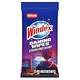
- WINDEX GAMING WIPES: effortlessly clean all your gaming gear and gaming electronics in one easy step with our new Windex Gaming Wipes
- AMMONIA FREE: our ammonia-free formula is safe to use on all of your favorite gaming equipment like consoles, headsets, controllers, screens, keyboards, and more
- PRE-MOISTENED WIPES: each wipe instantly removes dust, dirt, and stubborn smudges and fingerprints leaving a streak-free shine
- ANTI-STATIC: great for cleaning and wiping down your gaming gear and electronics leaving behind no visible residue
- COMPACT RESEALABLE PACKAGE: store your pack of Windex Gaming Wipes anywhere in your home for whenever a quick and easy wipedown is needed
PROJ cannot find its support files
cs2cs depends on resources such as the PROJ database and datum-shift grids. The reference states that PROJ_DATA identifies the directory where those resources are found. If the variable points to the wrong directory, is unset in an environment that needs it, or the expected files were not installed, operations can fail before any coordinate is transformed.
A required datum grid is absent
Some transformations need a specific grid. PROJ’s documented example shows a request failing when a required NADCON5 grid is unavailable and --only-best is used. That is an operation-specific failure, not evidence that every cs2cs error involves NADCON5.
How do I fix cs2cs.exe errors on Windows?
Work through these checks in order. Keep the exact command and complete error text; changing several variables at once makes it difficult to tell which correction worked.
1. Record the reproducible case
- Copy the complete command line, including every option and both CRS definitions.
- Save a small sample of the input coordinates, preserving their original order and separators.
- Record the PROJ version reported by the installation or package that supplied
cs2cs.exe. - Copy the full console error, including warnings about grids, databases, axis order, or unavailable operations.
This information matters because behavior depends on the CRS pair, operation selection, available resources, axis rules, and PROJ settings. A shortened message such as “cs2cs failed” is not enough to identify the cause.
2. Validate both CRS definitions
- Check that the source CRS matches the coordinates in the input file. Geographic degrees, projected metres, and other units are not interchangeable.
- Check the destination CRS separately; do not assume that a familiar EPSG code is the one your project requires.
- If you use WKT or a PROJ string, compare the spelling, numbers, units, and datum parameters with the definition supplied by your data provider.
- When testing, use a simple, known CRS pair first. Once that succeeds, return to the production pair and its required transformation.
CRS syntax can be supplied as EPSG codes, WKT, PROJ strings, or recognized names, so an error in one representation may disappear when you correct the underlying definition rather than changing the file format.
3. Check the input axis order
For an authority-code definition, follow the axis order required by that CRS. In the documented EPSG:4326 example, provide latitude first and longitude second. Do not “fix” a swap by guessing from the output: test with a coordinate whose expected location you know, and document the order used by your source file.
Also popular on Amazon

- Ergonomic & Adjustable Design: Fight "text neck" and improve your posture. Designed for comfort, it offers an adjustable height (7.1in-8.5in) (1.4in adjustable range) and angle (5°-85°) Please note: cell phone stand is only 9 inches tall—the length of a standard pencil
- Without blocking subtitles Perfect for office desk Tiktok Face Time Zoom video—this is the ultimate kitchen desk essential for phones! Perfect viewing experience while reducing neck back strain, A must-have for gamers streamers desk, and anyone who values both style and support!
- Sleek & Stable Design fits Otterbox Case: Say goodbye to bent cables, tangles, and tip-overs! LISEN’s stylish adjustable desk phone holder features a built-in charging hole and smart cable management, keeping your phone secure and your workspace clutter-free cool gadgets for men
- ANTI-SLIP DESIGN free hands: The under 10.00 items easy gadgets back and the bottom of this kitchen essentials for women are fully covered by anti-skid silicone, which LISEN stand up desk decor can provide maximum protection device from any scratches and slides
- Your Perfect Viewing Companion:If your product arrives damaged or breaks within 365 days, reach out to LISEN for a quick and hassle-free solution. Struggling with assembly, like tightening the screw? We’ve got your back! Your experience matters to us. (Product including: phone Holder stand*1, screw*1, hexagon screwdriver*1, specification*1)
If your data was exported by a tool that conventionally writes longitude first, explicitly reorder the columns before feeding them to a command that expects the authority-defined order. Keep the original file unchanged so you can reproduce the transformation.
4. Verify the PROJ resource directory
- Find the data directory installed with the same PROJ build as
cs2cs.exe. It should contain the project’s database and any grids required by your operation. - Check the
PROJ_DATAenvironment variable in the shell or service that launches the command. A variable set in one terminal, account, or scheduled task may not be present in another. - Correct the variable if it points to an old installation, a removed drive, or a directory belonging to a different PROJ version.
- Run the same command again and read the complete message. If the error changes from “resource not found” to an operation or data error, the resource lookup problem may be resolved.
The variable identifies where PROJ looks for resources; it does not itself install a missing database or grid. If the files are absent, repair or reinstall the PROJ package or the GIS application that supplied it, using the package’s documented installation method.
Recommended Free Tools
5. Resolve missing-grid and best-operation errors
When a message says that a required transformation grid is unavailable, determine whether that grid is installed for the source and target area. Do not substitute an unrelated grid or rename a file to make the error disappear. The operation must use a grid appropriate to the datum transformation.
--only-best changes the result when the highest-quality operation cannot be used. In the documented NADCON5 example, enabling it causes an error if the required grid is missing. That strict behavior is useful when an approximate result would be unacceptable: it prevents the command from silently selecting a lower-quality alternative.
| Configuration | What happens when the required grid is missing | When it is appropriate |
|---|---|---|
--only-best enabled |
The documented example returns an error rather than completing with a lower-quality operation. | Use when the workflow requires the best available operation and must not produce an unqualified approximation. |
--only-best omitted |
In the documented example, PROJ can fall back to an approximate transformation that treats NAD27 and NAD83 as identical. | Use only when your accuracy requirements allow the fallback and you record that the result is approximate. |
The NAD27/NAD83 example has an error of several tens of metres for that specific transformation. That figure is not a universal estimate for other CRS pairs, regions, or grids. Assess the accuracy appropriate to your geographic area and application before accepting a fallback.
6. Re-run with a controlled sample
- Use one or two known coordinates rather than the entire production file.
- Keep the source and destination CRS definitions unchanged while testing one correction at a time.
- Confirm that the output has the expected axis order, units, and approximate location.
- Only then process the full dataset, retaining the command line and the PROJ version in the job record.
A successful command is not automatically a correct transformation. A swapped axis or an unintended fallback can produce numbers without producing useful geography.
Also popular on Amazon

- Easy Installation: Our gaming lights have been designed to enhance your entertainment experience. Simply position the led light bar next to your TV or game console to create a game room environment with ease. They come with USB power and a 60 inch cord for direct mounting and mobility
- Audio Syncing & Extensive Mode: The built-in high-sensitivity music sensor allows you to sync the TV led lights to your favorite music. Lights react and move to the beat of music, film and game audio, creating an incredible immersive sound and light experience – and all without the need for an additional hub. You can choose from 64+ patterns, including strobe, illusion, jump, energy, gradient, running, chasing, fluttering mode etc. Each mode can be applied to different scenes
- 64+ Chasing IC+RGB & W Effect: The independent control design of IC+RGB and white all-in-one multifunctional rgbw led bar lights monitor backlight allows you to easily switch the led lights for desk between IC+RGB and white to enjoy a variety of lighting effects, you can choose white lighting mode with high brightness for better illumination when working, etc. Choose IC+RGB lighting mode when you need to create an entertaining atmosphere for the light show, 16 million colours of Color changing rgb light bar let you dance to the beat and create a dynamic party atmosphere
- Dynamic and Dimmable Lights: 1%-full brightness free brightness adjustment gives you the flexibility to adjust dimmable led light bar for room decorations or a variety of occasions
- USB Powered: USB light bars for room can be powered by powernank, usb charger, TV, Monitor, laptop PC mainframe, making behind TV led lighting bar easy to install in any location.TV led lights are powered by the TV usb interface / PC mainframe, can be turned on/off synchronously with TV / PC
7. Escalate with complete technical details
If the error persists, provide the exact command, CRS definitions, a minimal input sample, PROJ version, operating-system details, the value or intended location of PROJ_DATA, the list of available grids, and the unedited error text to the maintainer of the application that installed PROJ. This lets someone reproduce the same operation instead of diagnosing a generic Windows executable.
Should I allow an approximate fallback?
Allow a fallback only when the resulting accuracy is acceptable for the purpose of the data and you can label the output accordingly. A map display or exploratory analysis may tolerate an approximation that a cadastral, surveying, engineering, or regulatory workflow cannot. The documented NAD27-to-NAD83 example demonstrates why: omitting --only-best can produce coordinates by treating the datums as identical, with an error of several tens of metres in that example.
There is no single error distance that applies to every transformation. The effect depends on the CRS pair, geographic area, datum, available grid, and selected operation. If the consequence of a wrong position is material, install the required grid or stop with an explicit error rather than accepting an unverified fallback.
Independent reader supportYour contribution helps us test, update, and keep practical guides available for everyone.Can a working cs2cs command still produce wrong coordinates?
Yes. A command can complete while interpreting the input in the wrong axis order or using a CRS that does not match the data. Validate the result against a known point, check the units, and confirm that the operation and any fallback choice meet your accuracy requirement. Treat a warning-free console as evidence that the syntax was accepted, not as proof that the geography is correct.
PC Slower Than It Used to Be?
A free scan shows the junk files, broken settings and background clutter dragging Windows down - then fixes them in one click.Free scan · Windows 10 & 11Outdated Drivers Are Slowing You Down
One free scan finds every outdated or missing driver and matches the right update for your exact hardware.Free scan · exact hardware matchIf you want an optional Windows troubleshooting shortcut after trying the manual checks, Outbyte PC Repair can look for common broken system elements, invalid redirects, shared DLL issues, settings that increase CPU, RAM or disk load, temporary and cache files, and application-crash records. It runs on Windows 11, 10, 8 and 7, offers a free trial by category for at least two days and then requires a subscription; it complements antivirus software rather than replacing it, and no tool repairs every crash.
Frequently asked questions
Can I delete cs2cs.exe to stop the errors?
Do not delete it solely because the name is unfamiliar. First identify the parent PROJ or GIS installation and determine whether another application calls it. Removing one executable can leave the installing application incomplete; uninstall or repair the owning package instead, and preserve the file for security analysis if its origin is suspicious.
Does cs2cs.exe require an internet connection?
The cited PROJ documentation describes local CRS databases and datum grids, not a universal internet requirement. A failure to find a grid is therefore not proof that the network is disconnected; check the local resource directory and PROJ_DATA configuration first.
Also popular on Amazon
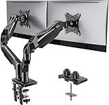
- Compatible with Wide Screens - To ensure compatibility with the dual monitor mount, your each monitor must meet three conditions at the same time: First, computer screens size range: 13 to 32 inches. Second, screen weight range: 4.4 to 19.8 lbs. Third, the back of the monitor screen must have VESA mounting holes with a pitch of 75x75mm or 100x100mm.
- Regarding the compatibility with desks - Your desk must meet three conditions at the same time: First, desk material: Only wooden desks are recommended, plastic or glass desks cannot be used. Second, desk thickness range: 0.59" - 3.54". Third, the bottom of the desk should not have any cross beams or panels, as this will interfere with installation. We recommend carefully checking that your desk and monitors meets all above conditions before purchasing.
- Dual C-Clamp Hold - Worried your dual monitors might wobble or slip? Our upgraded base uses a larger platform plus a dual C-clamp structure to lock the dual monitor arm firmly to your desk. Each arm safely keeps your screens steady while you type, click and game—no shaking, no sliding, just a clean and secure setup you can trust every day. It also provides Grommet Mounting installation choice, both options ensure stable and secure fixation for your 0.59" - 3.54" desk.
- Full-Motion Adjustment For Comfortable View - Pull the screen closer when you’re deep in a spreadsheet, push it back to watch videos, or rotate to portrait for coding — moving everything smoothly with just one hand. The monitor stand offers +85°/-50° tilt, ±90° swivel and 360° rotation. Raise your monitor up to 15.75″ to support a healthy sitting posture. Whether you’re working from home, gaming through the night, or switching between video calls and documents, getting the screens to your natural line of sight helps relieve neck, shoulder and back strain so you can stay focused longer with less fatigue.
- Keep Your Desk Organized: By lifting both screens off the desktop, this dual monitor stand opens up valuable space for your keyboard, notebook, docking station or a simple, clutter-free work area. Built-in cable management guides wires along the arms, keeping cords out of sight and out of the way. Enjoy a tidy, modern workstation that looks as good as it feels to use.
Why does the same command work in one terminal but fail in another?
Different shells, user accounts, services, and scheduled tasks can inherit different environment variables and can point to different PROJ installations. Compare the executable being launched, the PROJ version, and the effective PROJ_DATA value in each context.
Do these 3 things before closing this tab:
1Repair Windows errors before they cause bigger problems2Scan for outdated or missing drivers - takes under a minute3Clear out junk files and repair common Windows errorsIs the several-tens-of-metres difference normal for every fallback?
No. That distance belongs to the documented NAD27/NAD83 example and must not be generalized. Other CRS pairs and regions can have very different errors, so obtain the appropriate operation and evaluate its stated accuracy for your area.
Frequently Asked Questions
How can I tell which program installed cs2cs.exe?
Use the file’s Properties dialog to record its folder, version details and publisher, then check installed applications and the GIS or mapping package that uses PROJ. If no installed program explains it, preserve the file and investigate its origin before removing it.
Can cs2cs transform a whole coordinate file or only one point?
It can read coordinates from standard input or files, so it can process a stream or dataset rather than only an interactive single point. The input still has to follow the expected syntax and axis order for the selected CRS.
What information should I include when reporting a cs2cs failure?
Send the complete command, source and target CRS definitions, a minimal input sample, PROJ version, effective PROJ_DATA location, available grids, Windows context, and the full unedited error text. Those details distinguish a data problem from a missing resource or unsupported operation.
Quick wins for a faster PC:
Repair Windows errors before they cause bigger problemsFix Now →Fix the driver behind crashes, sound loss and screen glitchesFind Drivers →Clear out junk files and repair common Windows errorsFree Scan →When is it better to stop instead of accepting a fallback transformation?
Stop when the output will support surveying, engineering, legal boundaries, regulated reporting, or another task with a defined accuracy requirement and the needed grid is unavailable. Install the correct resource or obtain an approved transformation rather than silently labeling an approximation as exact.
Quick Recap
Product prices and availability are accurate as of the date/time indicated and are subject to change. Any price and availability information displayed on Amazon at the time of purchase will apply.

